Location data is managed via the itris Management Utility (IMU) Data area.
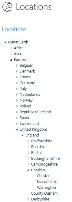
The Locations list is in a tree format, where you can add multiple layers. Ensure you have selected the parent location level you wish to create the location under when creating a new location as you are not able to move a location once it is created.